At the municipality’s request, a hydrography-oceanography student from ENSTA Bretagne is conducting a study on the movement of ocean currents in the picturesque harbor of Argenton. This natural environment is located in the village of Landunvez in North Finistère. The study seeks to outline the most appropriate models for reversing the siltation observed within this sensitive setting. Tide gauges are currently being installed…
Steady siltation since the 1940s
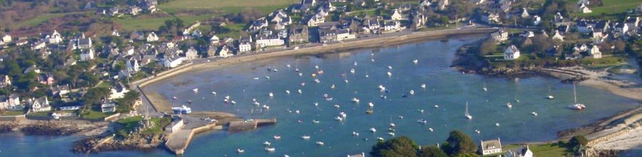
Around 200 yachtspeople use this quintessential little Breton harbor on the northern tip of Finistère. It is well protected by Yoc’h island opposite and the Vivier peninsula which closes the cove to the west.
During World War II, the occupying forces particularly added reinforcements to the access road to the Vivier peninsula to leverage this position. It was ideal for watching over the entrance to the Chenal du Four (waterway to the far west of Finistère, in the Iroise sea, before the entrance to Brest harbor).
The main impact of these coastal developments has been to completely stop one of the two tidal flows coming into the port by major coefficients. Later on, the construction of a small dike only exacerbated a steady phenomenon of siltation which has now been observed for 70 years. More recently, incidents of biological pollution (green algae) have also added to the problem.
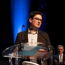
Eric Hassan, President of the Argenton harbor users association (AUPA) (and alumnus of ENSTA Paris, class of ‘89):
Argenton marina in Landunvez nestles amidst unspoilt natural scenery, steeped in a rich tin trading past. Today, it is a haven of peace for many local yachtspeople. Our small boats are well protected there from the northwesterly and southwesterly winds, by two peninsulas (Saint Laurent and Vivier) and the very wild Yoc’h island. Passing sailors are welcome at the "visitor" moorings. Once there, you’ll perhaps discover that there is no need to sail across the oceans to find a paradise – which we are trying hard to protect..."
Understanding and modeling the phenomenon to outline solutions
The harbor’s siltation is a worry for the municipal team, headed up by Christophe Colin, and the AUPA, chaired by Eric Hassan.
In order to analyze the phenomenon of siltation more closely and model a solution, an application project was put forward at ENSTA Bretagne.
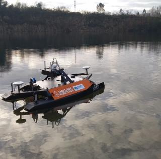
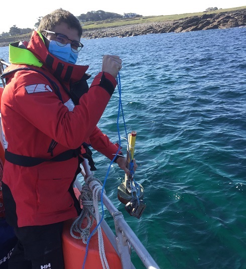
- The student in charge of the project, Jean-Baptiste Roustan, is currently installing a series of tide gauges on the harbor floor (three are planned). The three devices will record the variations in water height as the tides come and go.
- These datasets will be used to validate the model concerning the tidal current movements in the harbor implemented for this study.
- Using this model, it should be possible to find out whether a development to improve the tidal current movements could be considered as a natural solution for cleaning the area of water.
ENSTA Bretagne
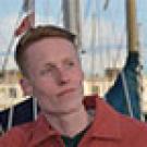
You are a "hydrography-oceanography" student, at the end of your course at ENSTA Bretagne. What skills did you need to successfully complete this study and what did you enjoy about this project?
Jean-Baptiste (hydrographer-oceanographer, ENSTA Bretagne 2021 class, X-2017):
This project required sound knowledge of the modeling tools and their descriptive capacity to ensure successful completion. In order to check that the model is consistent with physical reality, on-site data collection is needed to validate the simulations. The scientific and technical merits of this project stem from this twofold challenge. On a final note, one of the main reasons for my interest in this study was the opportunity to work in a coastal area, in close liaison with local stakeholders.
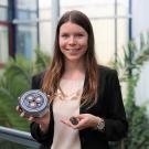
What would a "natural solution for cleaning the area of water", which acts on the tidal current movements, entail?
Amandine Nicolle (Professor, Hydrography-Oceanography Course Director):
Modeling the movement of tidal currents with the topography of the area will give us insight into the hydrodynamic reasons behind the harbor’s siltation. Once this knowledge has been acquired, this model can be used to see how a change in terrain level (digging in one area or adding an obstacle for example) can affect this movement. Using the digital model, it is possible to measure the impact of each solution considered, to find the most natural way of addressing this siltation problem, with as little impact as possible on the neighboring environment.
contact
Amandine Nicolle
Research Professor
Coordinator of Master’s programs in Hydrography-Oceanography