A team of ENSTA Bretagne researchers make a significant contribution to Lab-STICC’s "M3" scientific project. Indeed, the campus boasts an extensive skill set for improving, expanding and enhancing the reliability of marine environment mapping. This yields insight into the physics of measurement, from its capture to its interpretation.
Research areas for understanding the marine environment
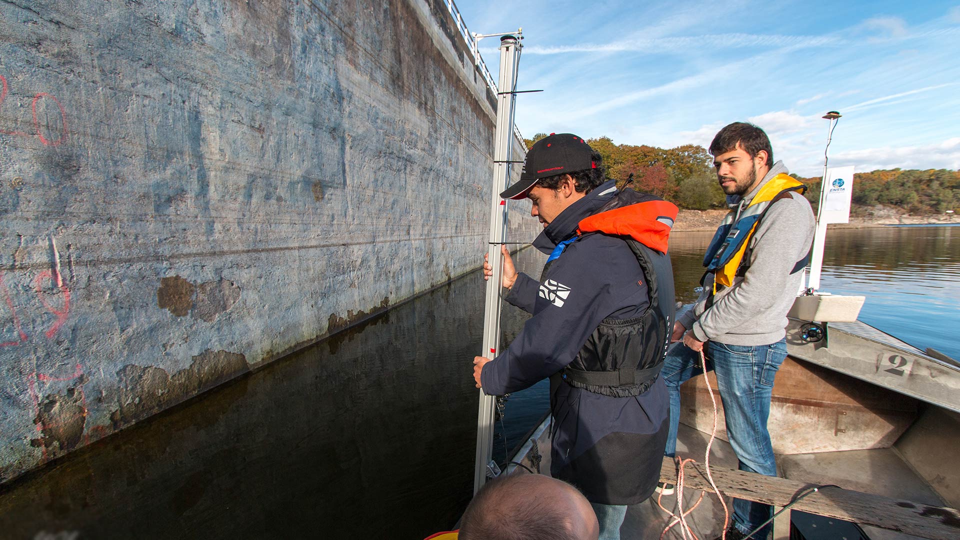
With the increase in insightful, precise and heterogeneous information about the marine environment come efforts to improve the processing of these countless datasets from varied observation systems (underwater, marine and spatial). Only judicious, joint use of this metadata can enable a faithful description of the environment.
To that end, the team explores different aspects of marine data analysis:
- design of the observation system through the assembly of sensor bricks,
- consideration of the physical reality of this system and its measurements,
- qualification, analysis, interpretation and representation of the data acquired.
Examples of applications
- Optimizing hydrographic survey systems: by machine learning of massive bathymetric data
- Observing and describing the atmosphere by modeling the atmospheric propagation of GNSS signals in the marine environment
- Characterization of the quality of water column estimations from multispectral data
Expertise harnessed for analyzing marine data
- marine acoustics
- passive acoustics
- marine data processing
- marine imaging
- machine learning
- data science
- big data
- sensor systems
Collaborations
Here are some examples of partners with whom this research is conducted.
- Companies: Hytech Imaging, Naval Group, Thales, ECA-robotics, CIDCO, iXblue
- Institutions: DGA, Shom, IGN, Ifremer
- Academia: Université Laval, Woods Hole Oceanographic Institution, Centre de Géomatique du Québec
M3 research projects on description of the marine environment
CALHYB project: HD imaging in coastal shallow water
Coastal areas vulnerable to climate change, evolving coastlines and the monitoring of flood-prone areas call for regular measurements and suitable imaging and measurement systems. This is the purpose of the CALHYB research project on which ENSTA Bretagne is bringing its imaging expertise to bear for the observation of the marine environment.
What is innovative about this project? A ground-breaking pair of sensors embedded on an aerial drone, for HD imaging
MAP-IO project: climate observatory in the Indian and Southern Oceans
The "MAP-IO" scientific program aims at setting up a climate observatory aboard a French research vessel (the Marion Dufresne) for studying the Indian and Southern Oceans.
How is the school contributing? By developing the system for continuously measuring atmospheric humidity, using GNSS signal analysis methods.
To deduce the level of humidity in the air, the team is tapping into the phenomena whereby the propagation of GNSS signals is delayed because of the water vapor in the atmosphere.
contact
Pierre Bosser
Associate Professor in Hydrography, Oceanography
IT Department
Lab-STICC Laboratory / AI&Ocean Department / M3 Team


news