Coastal areas vulnerable to climate change, evolving coastlines and the monitoring of flood-prone areas call for regular measurements and suitable imaging and measurement systems. This is the purpose of the CALHYB research project on which ENSTA Bretagne is bringing its imaging expertise to bear for the observation of the marine environment.
What is innovative about this project? A ground-breaking pair of sensors embedded on an aerial drone, for HD imaging
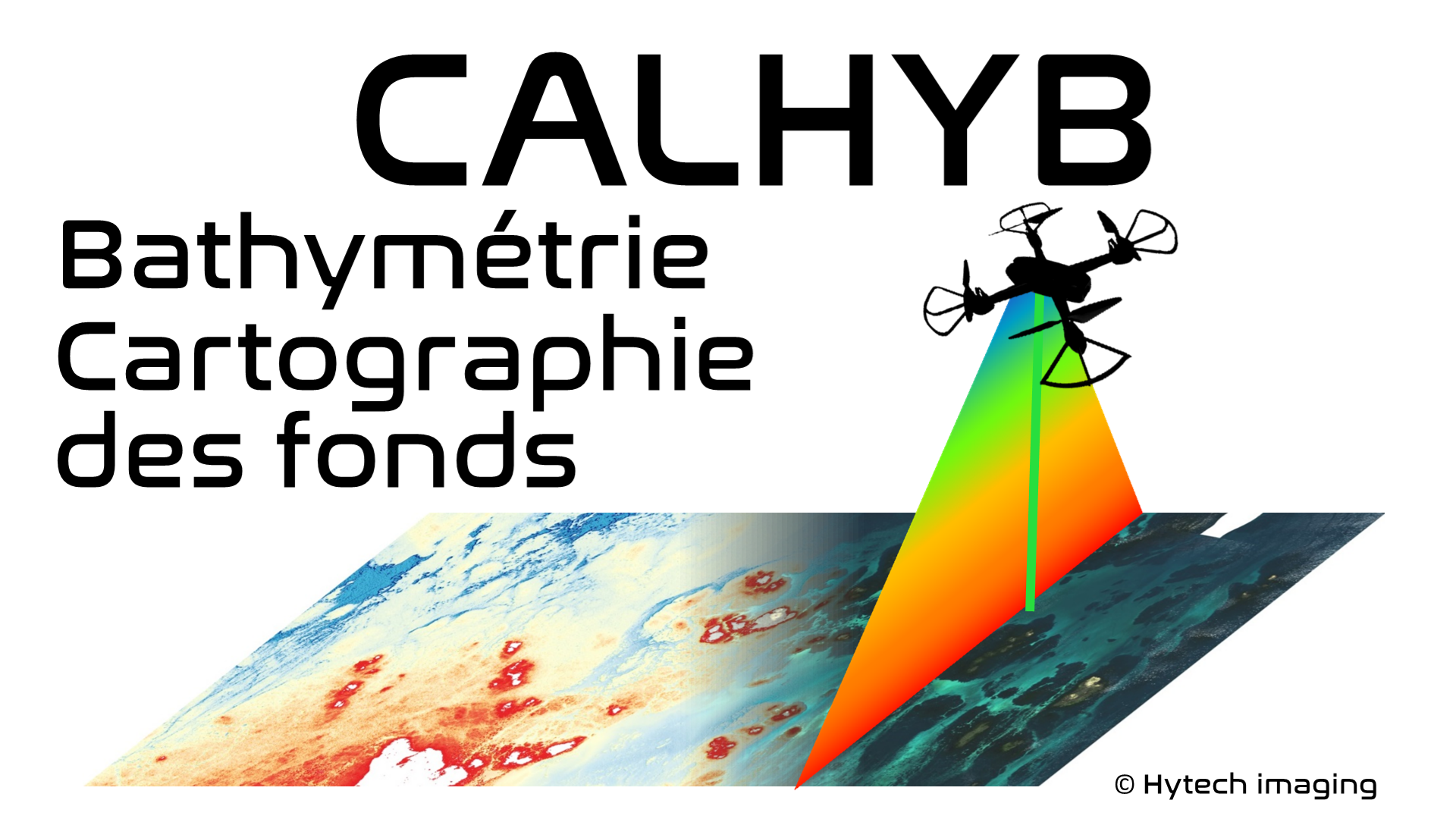
Afin de cartographier les zones littorales et zones maritimes à petits fonds, le projet CALHYB mise sur un système équipé de deux capteurs de pointe, complémentaires, intégrés sur un drone aérien.
In order to map coastal areas and shallow maritime areas, the CALHYB project is harnessing a system equipped with two complementary, cutting-edge sensors, embedded on an aerial drone.
A passive hyperspectral imaging sensor will be combined with a bathymetric laser profiler. By combining the information received from both these sensors, it will be possible to generate reliable, high-resolution imaging of the seabed, revealing both the bathymetry and the nature of the sea floor.
Guillaume Sicot, research professor at ENSTA Bretagne (Lab-STICC, AI & Oceans Dept), explains:
The aim is to take advantage of the high level of detail of spectral imaging (high-resolution) and the accuracy provided by the laser profiler to increase overall reliability.
The project’s merits also concern the embedding of these sensors into an aerial drone by minimizing the energy consumption and weight constraints.
This project is led by Hytech-Imaging with ENSTA Bretagne as academic partner for its expertise in hydrography, sensor systems and underwater information acquisition and processing, and SensUp (subsidiary of the Lumibird Group).
Find out more