An ENSTA Bretagne marine data analysis research team (Lab-STICC, AI & Oceans Dept) is participating in the "MAP-IO" scientific program aimed at setting up a climate observatory aboard a French research vessel for studying the Indian and Southern Oceans. The school’s contribution bears on the development of the atmospheric humidity measuring system.
One of the key components of climate research is measuring the humidity in the atmosphere. This is one of the focuses of a vast program dedicated to observing the climate and changes in meteorological phenomena in the Indian and Southern Oceans, called MAP-IO. This name refers to the research vessel which will be fitted out with the measuring systems: the Marion Dufresne (Marion Dufresne Atmospheric Program Indian Ocean, www.mapio.re).
Contribution of the Lab-STICC’s "Marine Mapping & Metrology" (M3) team on the ENSTA Bretagne campus: continuous analysis of marine data
In the context of the MAP-IO program, since 2020 the ENSTA Bretagne team has been harnessing its expertise in the analysis of data traditionally used for satellite navigation (GNSS: GPS, Galileo, etc).
Based on the analysis of GNSS signals recorded by a high-accuracy antenna, the team has developed tools for deducing the humidity at the vertical level of the antenna.
Pierre Bosser, research professor at ENSTA Bretagne/Lab-STICC (AI & Oceans Dept, M3 team), explains:
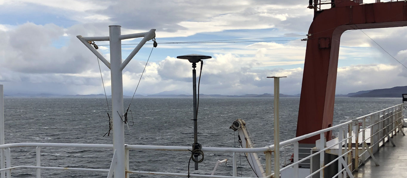
A high-accuracy antenna is positioned on the deck of the Marion Dufresne (photo, April 2022 off the Kerguelen islands). We know that the GNSS signal captured by the antenna is delayed by the water vapor in the atmosphere. We can deduce the atmospheric humidity at the vertical level of the antenna from this delay in the propagation of GNSS signals.
The analysis is carried out automatically, on a daily basis, and the results are forwarded every morning to the University of Reunion Island. By the time the project comes to an end, we hope to be able to perform this analysis continuously so as to inform weather forecasting models within very short timeframes (approx. 1 hour).
.
14 partners are involved in the consortium developing the MAP-IO observatory
- 8 universities: Reunion Island, Clermont-Auvergne, Aix-Marseille, Toulon, Sorbonne, Lille, Toulouse III Paul Sabatier and Littoral Côte d'Opale
- ENSTA Bretagne,
- CNRS,
- Météo-France,
- IGN,
- IRD,
- and the CEA.